
Rainfall in the Hillsboro area so far this year is just a few slots shy of breaking a 120-year record, a meteorologist said, and further showers in coming days will likely complicate planting for local farmers already late putting their crops in the ground.
Ashley Novak, a meteorologist at the National Weather Service office in Wilmington, said a cumulative 30.96 inches of rain has fallen since the beginning of the year, ranking the first half of 2019 in fifth place for precipitation in the same time frame since 1893.
This month alone, there has been 3.44 inches of rainfall, Novak said, topping an average of 2.22 inches.
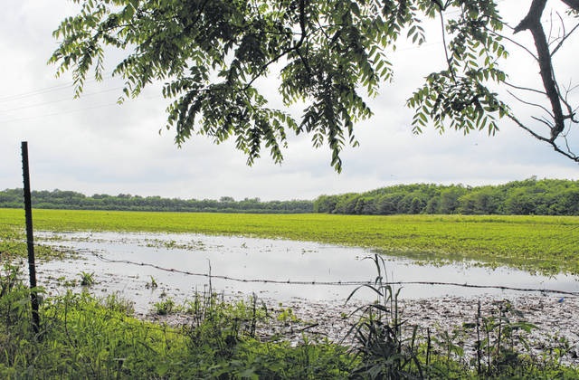
Brooke Beam, the agriculture and natural resources/community development educator at the Highland County OSU Extension office, said the rain has “provided a lot of challenges” for farmers so far this year.
“In a lot of cases, it’s delayed planting,” she said. “There have been about 10 inches more rain this year than we normally have, but that being said, I think our area of Ohio is a little bit better off than some places in Northwestern Ohio.”
Beam said farmers have been able to get the majority of their crops in, but there are still “quite a few” whose planting is not finished.
“It’s a difficult year for sure,” she said.
According to Novak, Friday is the first day the area can expect dry weather, but additional thunderstorms will likely move through the area over the weekend.
“It’s a very wet pattern we’re in,” she said, and “it’s not really showing any signs of letting up here any time soon.”
Novak said there has been measurable precipitation — at least 0.01 inches — 75 days so far this year.
Novak advised locals to heed flood warnings and flash wood warnings, and to stay out of deep water on roadways and other areas.
“We have the saying, ‘Turn around, don’t drown.’ Heed all road closures from flooding, and if you see water covering the road, turn around and don’t drive through it,” she said.
Novak said it only takes six inches of flowing water to knock a person off their feet, and less than two feet of water to carry a car off the road.
“It’s good for people to heed all the warnings that are put out for their location,” she said.
NWS forecasters predict showers and thunderstorms Tuesday with a high near 77 and rainfall amounts between a quarter and half an inch.
Wednesday, expect more showers and thunderstorms mainly after 10 a.m. and a high near 81, the NWS said.
There is an 80-percent chance of showers and thunderstorms in the area on Thursday, and an expected high of 76.
Forecasters predict Friday will be mostly sunny with a high near 79, but showers and thunderstorms will likely return Saturday, Sunday and into Monday, according to the NWS.
Reach David Wright at 937-402-2570.

