
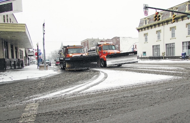
Highland County residents experienced snowfall in the 1-3 inch range on Friday, according to most weather maps, along with temperatures hovering slightly above the 20-degree mark.
Even before the snow hit, schools had closed or arranged for early dismissals. Just slightly to the south, counties such as Adams and Brown, as well as the northern Kentucky region, experienced heavier snowfalls, ranging anywhere from four inches to as much as 10 inches of snow.
Flurries were expected to linger until around 3 a.m. Saturday. Throughout the day Saturday, the forecast called for cold temperatures, with a high in the upper 20s.
A slight warming trend was predicted, with a high of 32 on Sunday, 41 on Monday and 39 on Tuesday, under partly cloudy skies each day.
Roads were slippery, and plows and salt trucks from cities, townships, the county and the state were out in force on Friday afternoon.
The Associated Press reported that one in seven Americans would get at least half a foot of snow outside their homes when this weekend’s big storm had finished delivering blizzards, gale-force winds, whiteout conditions and flooding to much of the eastern United States.
The first flakes of what could become two feet or more of wet, driving snow began falling in Washington Friday afternoon, sloshing in from the Ohio River Valley looking just like the forecasts promised.
Conditions quickly became treacherous along the path of the storm. Arkansas and Tennessee got eight inches; Kentucky got more than a foot, and states across the Deep South grappled with icy, snow-covered roads and power outages. In Mississippi, the storm spawned two tornadoes.
At least seven people died in storm-related crashes, including Stacy Sherrill, whose car plummeted off an icy road in Tennessee. Her husband survived, but it took him hours to climb up the 300-foot embankment and get help.
Officials warned people to shelter in place as the blizzards continue.
“The forecast does not show any evidence of lightening up,” Washington Mayor Muriel Bowser said, stressing the “life and death implications.”
The good news? Meteorologists appear to have gotten this storm right. Predictions converged and millions of people got clear warnings, well in advance. Blizzard warnings and watches stretched through New York City into New England, stopping just short of Boston, but the Washington area should get hit the hardest.
“This is probably going to be one of the top three snowfalls of all time for Washington,” said Daniel Petersen, a forecaster at the National Weather Service’s Weather Prediction Center in College Park, Maryland.
As food and supplies vanished from store shelves, states of emergency were declared, lawmakers went home and schools, government offices and transit systems closed early around the region. Thousands of flights were canceled, sporting events were called off, bands postponed concerts and NASCAR delayed its Hall of Fame induction ceremony.
Broadway’s shows were still going on in New York, but as far south as Atlanta, people were urged to stay home to avoid a repeat of the city’s “icepocalypse,” when a relatively mild winter storm in 2014 caused commuter chaos for days.
All the ingredients have come together for a massive snowfall and gale-force winds, causing white-out conditions and dangerous flooding. The winds initially picked up warm water from the Gulf of Mexico; now the storm is taking much more moisture from the warmer-than-usual Gulf Stream, and swirling slowly over Virginia and Maryland.
Snowfall could continue for a day and half, leaving accumulations of two feet or more in the Washington-Baltimore area. Philadelphia’s forecast was increased Friday to 18 to 24 inches by Sunday morning. New York could get 8 to 10, though some forecasts suggest more, Peterson said.
Put another way: 82 million Americans will get at least an inch of snow, 47 million more than 6 inches, and 22 million Americans more than a foot, Ryan Maue at WeatherBell Analytics said Friday.
The storm could easily cause more than $1 billion in damage, weather service director Louis Uccellini said.
Fortunately, temperatures will be just above freezing after the storm passes in most places, and there’s no second storm lurking behind this one, making for a slow and steady melt and less likelihood of more floods, Peterson said.
Travel was already impossible across a wide swath of Kentucky on Friday. Nashville, Tennessee was gridlocked by accidents. Several drivers died on icy roads in North Carolina. In Washington, Baltimore, and Delaware, archdioceses reminded people that dangerous travel conditions are a legitimate excuse to avoid showing up for Sunday Mass.
In New Jersey, coastal flooding and the loss of beaches from high surf were major worries. Republican Gov. Chris Christie canceled presidential campaign events in New Hampshire, which should be spared from the storm. “I’m sorry, NH but I gotta go home – we got snow coming,” Christie wrote on Twitter.
In Washington, the federal government closed its offices at noon Friday, all mass transit was shutting down through Sunday, and many people stayed home. President Barack Obama was hunkering down at the White House, while Republican presidential candidate Carly Fiorina addressed anti-abortion activists at the annual March for Life as the storm closed in.
“I would come here if it were thunderstorming,” said Kristlyn Whitlock, 20, who came from Steubenville, Ohio, wearing four layers of pants and five layers of tops to stay warm.
As the snow began falling in Arlington, Virginia, the parking lot at a Safeway supermarket looked like the mall at Christmas, with drivers lining up to snag parking spaces.
In downtown Baltimore, social worker Sean Augustus raced home, stocked with flashlights and water.
“I think it’s going to be a bad storm,” but Baltimore tends to come together when disasters strike.
“This is when you’ll see Baltimore city in a different light,” Augustus said. “You’ll see neighbors coming together to help each other. That’s the side of Baltimore people rarely see.”
A similar spirit was evident in Annapolis, where 350 midshipmen from the U.S. Naval Academy signed up to shovel people out.
Elsewhere, people woke to snow and ice, and then got stuck on dangerous roads. A jack-knifed tractor-trailer started “pure gridlock” around Nashville, where Tennessee Highway Patrol Lt. Bill Miller said snow plows and salt trucks couldn’t keep up with the weather.
All major airlines have issued waivers for the weekend, allowing passengers to rebook onto earlier or later flights to avoid the storms. More than 6,000 flights were canceled Friday and Saturday – about 12 percent of their schedules, according to the flight tracking service FlightAware. By Sunday afternoon, airlines hope to be back to full schedules.
Train service could be disrupted by frozen switches, the loss of third-rail electric power or trees falling on wires. Across the region, track workers, power company employees, road crew members, firefighters and other first-responders were mobilized for the long weekend. In New York City, 79 subway trains will have “scraper shoes” to reduce icing on rails, the Metropolitan Transit Authority said.
“For our region, this is good timing,” said Jeffrey Knueppel, general manager of the Southeastern Pennsylvania Transportation Authority, which is suspending almost all service around Philadelphia Saturday. “Saturday is the day to stay home and Sunday will give us a chance to really clean things up.”
At least one industry could benefit: Eastern ski resorts, which suffered from December’s record high temperatures.
“We’re thrilled,” said Hank Thiess, general manager at the Wintergreen ski resort in central Virginia, where 40 inches was expected. “We’re going to have a packed snow surface that will just be outstanding.”

