
Editor’s note: For many years, local historian Jean Wallis provided a feature to The Times-Gazette called “Highland Guideposts.” She is updating and resubmitting some of those articles from time to time, including this one.
On March 1, 1784, Virginia ceded the Territory Northwest of the River Ohio to the United States Congress. Knowing that she would not have sufficient land in the Cumberland Reservation of Kentucky to pay her soldiers on the Virginia Line of the Continental Establishment, she reserved the land west of the Scioto and East of the Little Miami Rivers and northward from the Ohio River 141 miles.
The Deed of Cession of the Northwest Territory to the United States was executed by the Commonwealth of Virginia. The document was signed by Thomas Jefferson, Samuel Hardy, Arthur Lee and James Monroe, Delegates for the Commonwealth in the United States Congress.
The Virginia Military District covered over 6,570 square miles and contained approximately 4,209,800 acres of land. It was one of the original nine major subdivisions of Ohio lands, and the only one not using a rectangular survey system.
The VMD lands comprised all or part of 23 Ohio counties. Adams, Brown, Highland, Clinton, Fayette, Madison and Union lay entirely in the VMD. Hamilton, Clermont, Warren, Greene, Clark, Champaign, Logan, Auglaize, Hardin, Marion, Delaware, Franklin, Pickaway, Ross, Pike and Scioto lies partly in the VMD.
“Over 16,125 meters and bounds (indiscriminate) original surveys are found in the Virginia Military District, thus creating a patchwork of surveys which, from the air, resemble a giant jigsaw puzzle,” according to a history of the transaction, “because of the number of surveys and the difficulty of finding the physical objects they relied upon, thus giving rise to the most litigated land area in Ohio.”
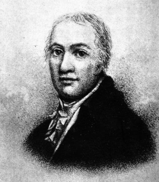
James Henry Thompson, a native of Kentucky, who after his marriage to Eliza Jane Trimble, daughter of former Ohio governor Allen Trimble, removed to Highland County and spent the greater part of his life as a land lawyer in the complex titles of the VMD.
Col. Richard Clough Anderson was appointed Principal Surveyor of the lands allotted to the Virginia soldiers, including Kentucky and the VMC by a Board of Officers named in an act of the Virginia State Legislature on October, 1793. He opened his office at Soldier’s Retreat near Louisville, Ky., on July 20, 1784.
The bounties ranged from 100 acres to 15,000 acres depending on rank and length of service. The heirs of a soldier or officer killed in the war were entitled to the bounty. Virginia issued bounty land warrants for 1,146,950 acres in the Cumberland reservation in Kentucky an the Virginia Military District in Ohio for Revolutionary War Service.
Virginia also issued land warrants for the French and Indian War services. Twenty-five percent of the VMD (1,035,408) acres was patented to 25 individuals. Virginia Military warrants could be assigned and transferred and often were, allowing the above.
The first survey in the VMD was run by John O’Bannon, number 388, on Nov. 13, 1787 for 1,400 acres of land in what is now Clermont County for Col. John Nevill. The village of Neville is located on this survey.
By the year 1790, all the lands in the Cumberland Reservation in Kentucky had been surveyed. On Aug. 10, 1790, Congress passed an act authorizing locations could be made in the VMD. At this time, Nathaniel Massie was appointed a deputy surveyor. Massie, between the years of 1790 and 1800, would survey 750,000 acres of the VMD.
To claim land in the VMD: “A warrant was sent to the Principal Surveyor. He would give it to a Deputy Surveyor who would give a general description of the claim (entry) and then run a survey. Virginia permitted a 5 percent error factor for VMD surveyors, but this was often exceeded. Following the acceptance of the survey, the warrant was sent to the Federal Government and a U.S. Patent issued. In Ohio, the entry number and survey number are the same. For their services, Deputy Surveyors often received 20 to 50 percent of the acres called for in the warrant or cash.
“Virginia relinquished and ceded to the Federal Government its claim to any unlocated land in the VMC on Dec. 8, 1852. In 1871, Congress ceded this land to the state. Ohio set this land aside in 1872 as an endowment for Ohio State University. At the time, 76,735 acres were believed available for sale by the University. Ohio State University sold or quit-claimed these lands to individuals until the 1940’s. Copies of the deeds are in the OSU Archives, Columbus.”

